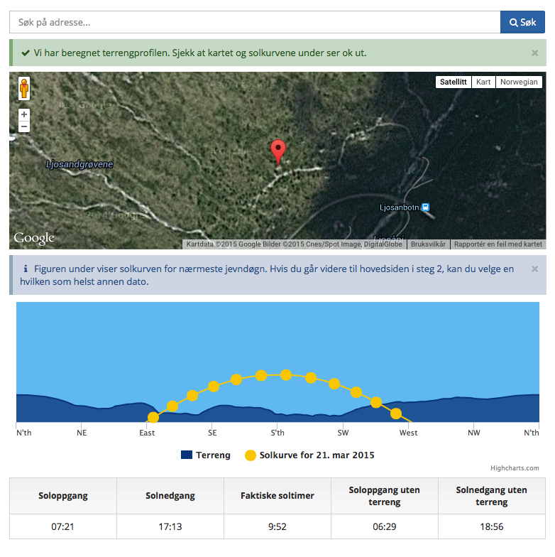
I set up a Suncurves page today for El Capitan Bridge, the best photo location in Yosemite, according to Gary Hart. Here’s what the horizon looks like from that point, and how the sun moves across the sky today, April 8th:
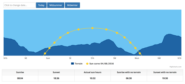
You see El Capitan itself in the right part of the image (looking North/Northwest from the bridge), and the formations near the center of the image are the Cathedral Rocks.
If you visit the Suncurves analysis for this location, you can choose any day of the year and see when the sun rises and sets on that particular day. Invaluable for planning a photo shoot or just a visit to this amazing spot.
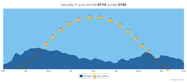
If you like this, you can see a map of sunset times for all of Yosemite here:
https://erik-suncurves.cartodb.com/viz/ddf8ee00-fb4d-11e5-b493-0e5db1731f59/public_map
Zoom in or pan around, but note that this is just for one day (the longest day of the year).
You can also set up analyses like the one for El Capitan bridge for any other location. Since we use global terrain height data, we mean any location.
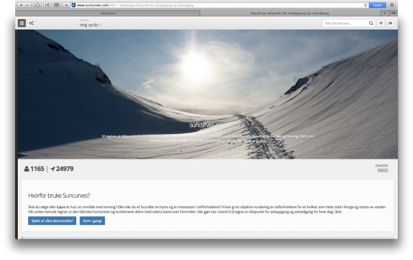
It’s easy to do this. Visit our site, enter an address, and let us do the rest. What you get is a page like this (click on the picture to see an example for Boulder, Colorado):

The free version gives you a limited amount of information, but it still gives you a good overview. When you pay for a full version, you also get to download a complimentary PDF calendar with sunrise and sunset times for each day of the year on just one page. Here’s an example for a more mountainous place, Banff in Canada (click to view in more detail):

Besides getting the daily data, you can also see what the terrain looks like in a 360-degree panoramic view from your location, as well as the paths that the sun follows in midsummer, midwinter, and on the equinoxes.
So get one or more sunlight analyses for free today. We hope to see you on our site!